English
要旨
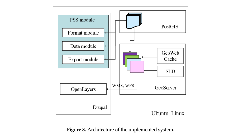
Participatory sensing is the process in which individuals or communities collect and analyze systematic data using mobile phones and cloud services. To efficiently develop participatory sensing services, some server-side technologies have been proposed. Although they provide a good platform for participatory sensing, they are not optimized for spatial data management and processing. For the purpose of spatial data collection and management, many web GIS approaches have been studied. However, they still have not focused on the optimal framework for participatory sensing services. This paper presents a web GIS framework for participatory sensing service (FPSS). The proposed FPSS enables an integrated deployment of spatial data capture, storage, and data management functions. In various types of participatory sensing experiments, users can collect and manage spatial data in a unified manner. This feature is realized by the optimized system architecture and use case based on the general requirements for participatory sensing. We developed an open source GIS-based implementation of the proposed framework, which can overcome financial difficulties that are one of the major problems of deploying sensing experiments. We confirmed with the prototype that participatory sensing experiments can be performed efficiently with the proposed FPSS.
全文は GeoScience誌 より読むことが可能です。